Veterans Day: Mild and breezy
20s for lows by Friday morning
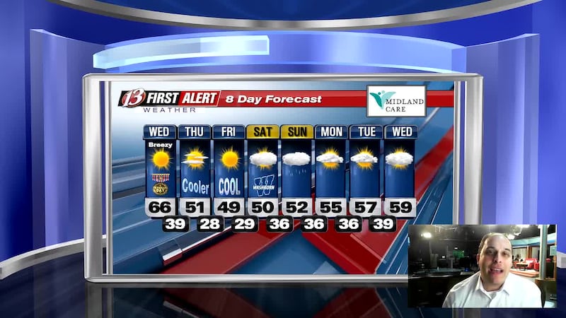
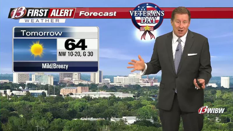
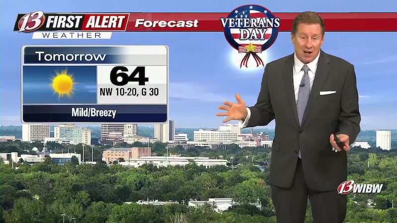
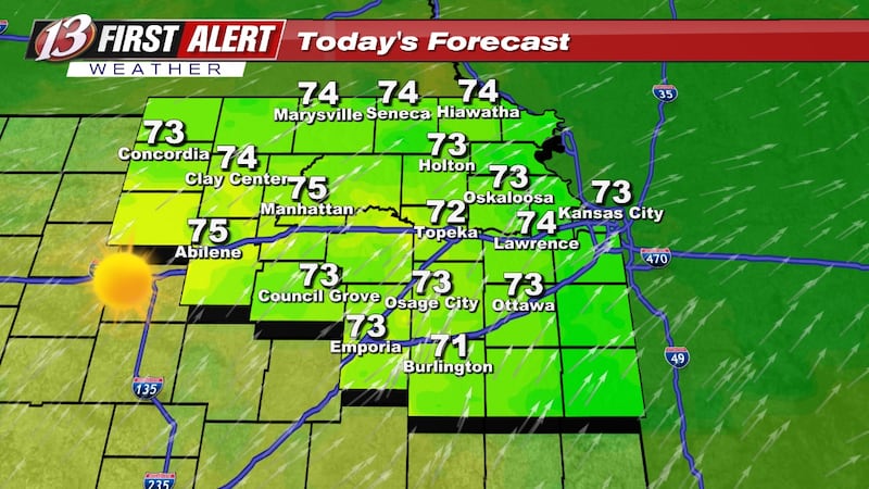
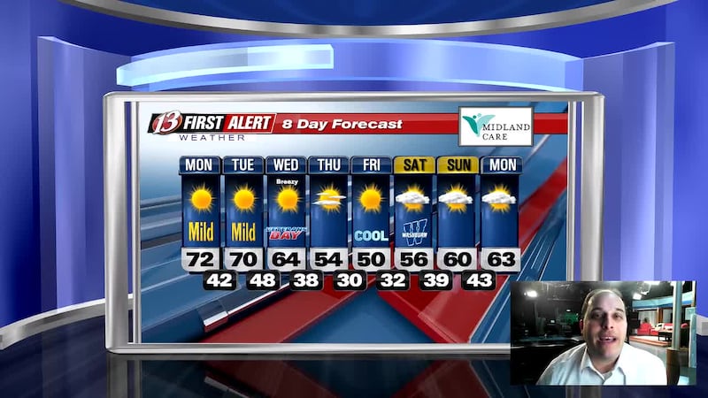
TOPEKA, Kan. (WIBW) - After a couple days in the 70s, we’ll be cooler but still mild today in the 60s with gusts 30-35 mph with much cooler weather to end the week. In fact we’ll get down in the 20s Friday morning for the first time since March 28. Plenty of sun continues through Friday with clouds returning this weekend including a chance of rain on Sunday.
Taking Action:
- Gusts 30-35 mph expected today: Tie down or bring inside any loose items that may blow away.
- Confidence is increasing on most if not all of northeast KS getting below freezing Friday morning and Saturday morning with most areas in the upper 20s and the first freeze of the season. With the extended growing season this year, if you still have any sensitive plants outside cover them or bring them in on those nights. Also make sure you protect outdoor plumbing including hoses and turning off sprinklers you still have on.
- Rain is possible Sunday, do NOT cancel outdoor plans at this time due to lower confidence on specific details and how much rain will fall.
- Check back daily for updates.
________________________
Plenty of sun will continue the rest of the work week even if there are few more clouds, especially tomorrow. Today will be the windiest day of the week and Friday is still trending to be the coolest day of the week with most areas stuck in the 40s which occurred last week too but this Friday will be sunny unlike the overcast skies of last week.
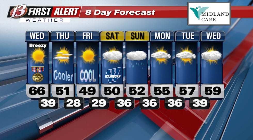
Today: Sunny. Highs in the mid-upper 60s, a few low 60s can’t be ruled out in extreme northeast KS. Winds NW 10-20, gusts up to 35 mph.
Tonight: Clear. Lows in the mid 30s to low 40s. Winds N around 5 mph.
Tomorrow: Mostly Sunny. Highs in the upper 40s to mid 50s. Winds N 5-15 gusts around 20 mph.
Lows in the mid 20s to low 30s Friday and Saturday mornings with highs mainly in the 40s although a few low 50s can’t be ruled out Saturday depending on cloud cover. Winds will likely remain 10 mph or less Friday through Sunday which will help with the cooler weather that will be in the area. The rain on Sunday is trending to be higher out toward central KS and south of I-70 but the storm track is subject to change leading to changes in the overall totals we’ll end up getting with the storm system so check back for updates.
Next week’s models still disagree on the overall temperature trend: If it does get warmer, how much warmer will it get. Also the fact at least some clouds may stick around daily next week which could also impact how warm it gets or how cool it stays. Any rain next week looks to hold off until the end of the week.
WAY TOO EARLY LOOK AT THANKSGIVING: One model goes out to Thanksgiving itself with temperatures that are trending to be in the upper 40s-low 50s for highs and dry not only Thursday but earlier in the week as well. This WILL change and is NOT the forecast but will continue to let you know here what models are indicating until it shows up in the 8 day.
**Catch the latest update at 10:30am Monday through Friday on www.wibw.com/livestream/ or watch on demand here
Copyright 2026 WIBW. All rights reserved.